by Lilly Knoepp, NCLocal
September 10, 2026
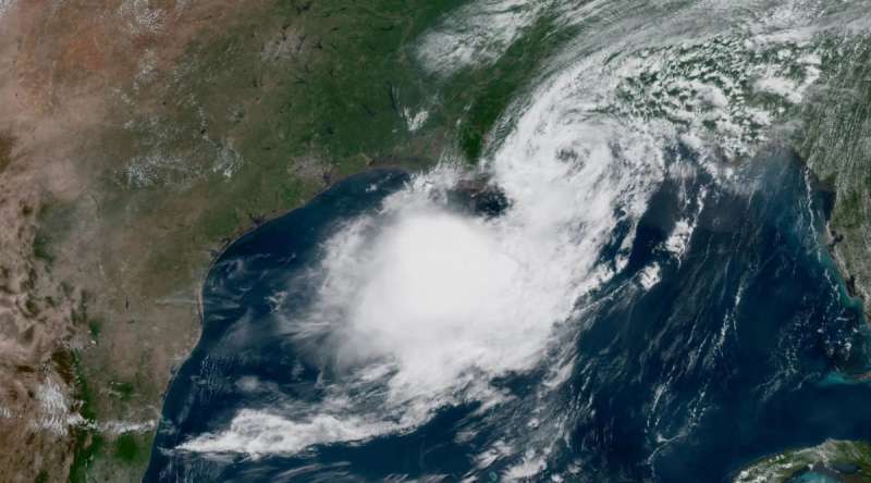
Today is the “climatological peak of the Atlantic hurricane season.” But unlike previous years, this hurricane season has brought a historically low number of hurricanes to the Atlantic.
The lack of storms is thanks in part to El Niño, a climate pattern in the Pacific Ocean that impacts the global weather patterns.
The National Oceanic Atmospheric Administration, better known as NOAA, forecasted a lower-than-average hurricane season in May and doubled down on their prediction at the end of August.
Important dates, where to vote, and what’s at stake: Cardinal & Pine’s 100% paywall-free 2026 Voter Hub in North Carolina.
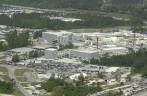
NOAA uses global current climate data as well as historic data to determine how intense a season might be, and much of that data is housed in Western North Carolina at the National Centers for Environmental Information (NCEI) in Asheville.
Craig Schreck, who works at NCEI as Interim Associate Director of the North Carolina Institute for Climate Studies at NC State University, explained that the center houses hundreds of data sets including satellite, radar, and temperature data.
“When I am in classrooms, I always tell them that it’s about a million times bigger than my phone. We have that equivalent of storage on site,” Schreck said.
While the middle of September is historically the peak of the Atlantic hurricane season, Schreck explained that this year differed because of strong patterns on another ocean: the Pacific.
“[El Niño]moves where the biggest thunderstorms are and changes the whole circulation of the globe and creates a lot more vertical wind shear for the Atlantic which basically knocks over the hurricanes before they can get going,” Schreck said.
Changes in El Niño have a big impact on potential storms including hurricanes.
“Every couple of years for reasons we don’t totally understand, those winds weaken, and all that hot water slushes back to the east,” Schreck said. “When the winds weaken. There’s nothing pushing it over there anymore. It’s all that the hot water comes back towards the Central Pacific. And that’s what causes the changes in the circulation.”
If a storm reaches hurricane levels in the Atlantic this year, it will be the latest storm in the calendar year on record. The current record is Sept. 11 from around 1950, Schreck said.
Schreck cautioned that even in a year with few storms, natural disasters are still possible.
“It only takes one storm. Two years ago, it was a major La Niña year. The Atlantic was record hot in 2024,” he said. “We thought we were going to have lots and lots of hurricanes. But then August and September was basically completely quiet until Hurricane Helene, of course.”
Changes in climate data tracking
Tracking global storms requires many resources, including hundreds of experts in climatology, meteorology and atmospheric science. When the Trump administration made cuts to thousands of federal positions in 2025, the now-defunct Department fo Government Efficiency (DOGE) laid off hundreds of NOAA employees.
Prior to the cuts, about175 NOAA staff worked in Asheville, according to BPR. The total number of employees laid off by DOGE was not released.
Schreck said about a third of staff left last April following the federal severance options. NC State staff have long worked at the NOAA office but that number has increased in recent years to about 50 NC State staff in the building, he said.
“The basic work hasn’t really changed. The people doing it certainly has,” he said. Schreck said fewer new data sets have been developed since the cuts, with a greater focus on maintaining current data sets.
Former NOAA employees launched a new website to house public climate data this summer. Climate.us re-creates the former “climate dashboard” from the government site with “more than a dozen key graphs related to climate change,” NPR reported.
The website also includes Climate.gov’s 15-year collection of news stories, climate literacy resources and classroom materials and other materials, according to the site.
North Carolina climate data tracking
While much of the hurricane tracking takes place at the national level with NOAA and the National Weather Service, state climatologists in North Carolina also provide contextual data to understand storms. The North Carolina State Climate Office is a public service center that covers the entire state.
“We think about a storm like Tropical Storm Fred a few years ago, at that point we were looking back at some of the storms from the September 2004 season, like Hurricane Francis and Hurricane Ivan,” Corey Davis, assistant state climatologist at the North Carolina State Climate Office, said.
Davis agrees with his federal counterparts that this year has a lower hurricane potential.
“If we think about the hurricane season as a dartboard where Mother Nature is throwing darts and seeing how many land, that kind of describes the seasonal outlook,” Davis said. “Certainly, if we have fewer storms this year, fewer darts hitting the board, that gives a little bit lower chance that we would see us in impacts locally. But it’s not a zero chance either.”
Davis is watching another side effect of El Niño – rainfall. He said heavy rain is expected in North Carolina this fall, as early as October. Rain doesn’t always mean flooding, he said.
“I think for folks in Western North Carolina, Helene is really the last big point of reference for what a lot of rain looks like,” Davis said. “The difference is that, Helene dropped 15 to 30 inches of rain over the course of three or four days. We don’t expect anything close to that with an El Niño, but we could see totals like that over the course of three or four months.”
If these rains stack up, that could lead to flooding in low lying areas, Davis said, so that will be something to keep an eye on during this wet fall.
Storm Prep Resources
- Track storms with the National Weather Service and follow local news to stay up to date.
- Keep an emergency kit of food and water for up to 72-hours including batteries, cash and other key supplies.
- Write a family emergency plan so that everyone knows where you will go in a disaster.
This article first appeared on NCLocal and is republished here under a Creative Commons Attribution-NonCommercial 4.0 International License.