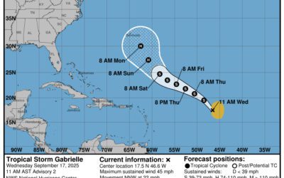
A two-day graphical tropical weather outlook from the NHC. (USA Today via Reuters)
Forecasters say there’s a significant risk that tropical weather will impact North Carolina, including still-recovering western North Carolina, early next week. Here’s what to know.
One year after Tropical Storm Helene swept through Western North Carolina, more storms are brewing, this time in the Atlantic.
The National Hurricane Center is currently watching two systems east of the U.S. as Hurricane Gabrielle continues to weaken. Humberto strengthened into a hurricane on Friday morning, Sept. 26, and is expected to intensify rapidly into a Category 4 storm over the weekend.
Additionally, Invest 94L is expected to become a tropical depression over the weekend in the area of the Bahamas, east of Florida. Potential impacts of the two storms on the U.S. and North Carolina remain difficult to predict, as the two could interact with each other in what’s known as the Fujiwhara effect.
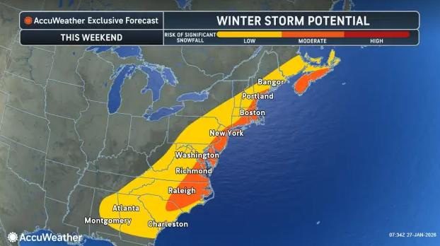
“While there remains considerable uncertainty in the long-range track and intensity of the system, there is a significant risk of wind, rainfall, and storm surge impacts for a portion of the southeast U.S. coast early next week,” the National Hurricane Center said.
“In a worst-case scenario, heavy rain from both tropical and non-tropical origins could bring prolonged, tremendous rain and flooding to parts of the Carolinas and Georgia,” AccuWeather said.
“Regardless of whether a hurricane makes landfall in the southeastern U.S. or not, strong winds will create large, chaotic swells that will propagate toward the southern and middle Atlantic coast late this weekend to the middle of next week.”
So far, there have been three hurricanes this season, Erin, Gabrielle and now Humberto, both of which rapidly intensified into major hurricanes. The next named storm for the 2025 Atlantic hurricane season will be Imelda.
Here’s what North Carolina residents should know about the potential impact of the storms.
Is there a hurricane coming to North Carolina? Potential storm impact
According to a recent report, AccuWeather hurricane experts are becoming “increasingly concerned about the possibility of a landfalling storm along the southeastern U.S. coast next week.”
Depending on how quickly the tropical rainstorm evolves into a named tropical storm and potentially a hurricane, the severity of wind, flooding and wave conditions will vary. Interaction with Humberto could also be significant, pulling the storm away from the U.S. or stealing some of its moisture. In this scenario, AccuWeather forecasters say rain impacts from the budding Imelda could be limited in the southeastern U.S.
However, if both storms remain separate with minimal interaction, Invest 94L could push onshore in the Carolinas early next week, possibly as a hurricane. A non-tropical storm bringing showers and thunderstorms to the Southeast this weekend complicates the situation further, with the potential to bring localized flooding regardless of further storm developments.
AccuWeather noted that the risk of “significant flash flooding” could extend as far west as the southern Appalachians.
Where is Hurricane Humberto? North Carolina hurricane tracker
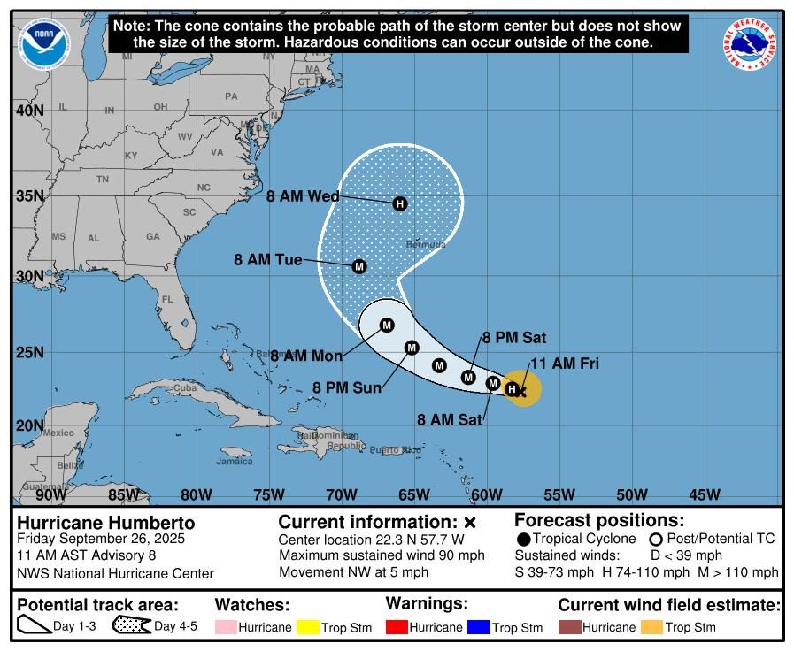
NHC cone for Hurricane Humberto.
Special note on the NHC cone: The forecast track shows the most likely path of the center of the storm. It does not illustrate the full width of the storm or its impacts, and the center of the storm is likely to travel outside the cone up to 33% of the time.
Special note about spaghetti models: Spaghetti model illustrations include an array of forecast tools and models, and not all are created equal. The Hurricane Center uses only the top four or five highest performing models to help make its forecasts.
The National Weather Service issued a hazardous weather outlook for Western North Carolina and the Piedmont, as well as northeast Georgia and Upstate South Carolina. The outlook calls for “scattered to numerous showers and thunderstorms” on the afternoon and evening of Friday, Sept. 26.
Main hazards noted from the weather will be the possibility of localized flooding from heavy downpours. The weather service weekend forecast for the Asheville area is:
Friday, Sept. 26 – A 50% chance of showers and thunderstorms, mainly after 1 p.m. Mostly cloudy, with a high near 78 degrees. Calm wind. New rainfall amounts between a .1-.25 inches, except higher amounts possible in thunderstorms.
Overnight, showers likely and possibly a thunderstorm before 8 p.m., then a chance of showers and thunderstorms between 8 p.m.-2 a.m., then a chance of showers after 2 a.m. Patchy fog after midnight. Otherwise, cloudy, with a low around 61 degrees. Calm wind. Chance of precipitation is 60%. New rainfall amounts between .25-.5 inches possible.
Saturday, Sept. 27 – A chance of showers and thunderstorms, then showers and possibly a thunderstorm after 2 p.m. Patchy fog before 11 a.m. High near 76 degrees. Calm wind. Chance of precipitation is 80%. New rainfall amounts between .1-.25 inches, except higher amounts possible in thunderstorms.
Overnight, showers likely and possibly a thunderstorm before 9 p.m., then a slight chance of showers between 9-11 p.m. Patchy fog after 1 a.m. Otherwise, mostly cloudy, with a low around 60 degrees. Calm wind. Chance of precipitation is 60%. New precipitation amounts of less than .1 inches, except higher amounts possible in thunderstorms.
Sunday, Sept. 28 – A 30% chance of showers and thunderstorms, mainly after 4 p.m. Areas of dense fog before 10 a.m. Otherwise, partly sunny, with a high near 78 degrees. Calm wind becoming east northeast around 6 mph in the afternoon.
Overnight, a chance of showers and thunderstorms. Mostly cloudy, with a low around 60 degrees. Chance of precipitation is 30%.
USA TODAY Network via Reuters Connect
Author

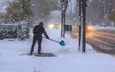
Arctic blast incoming to North Carolina. Will there be snow or ice?
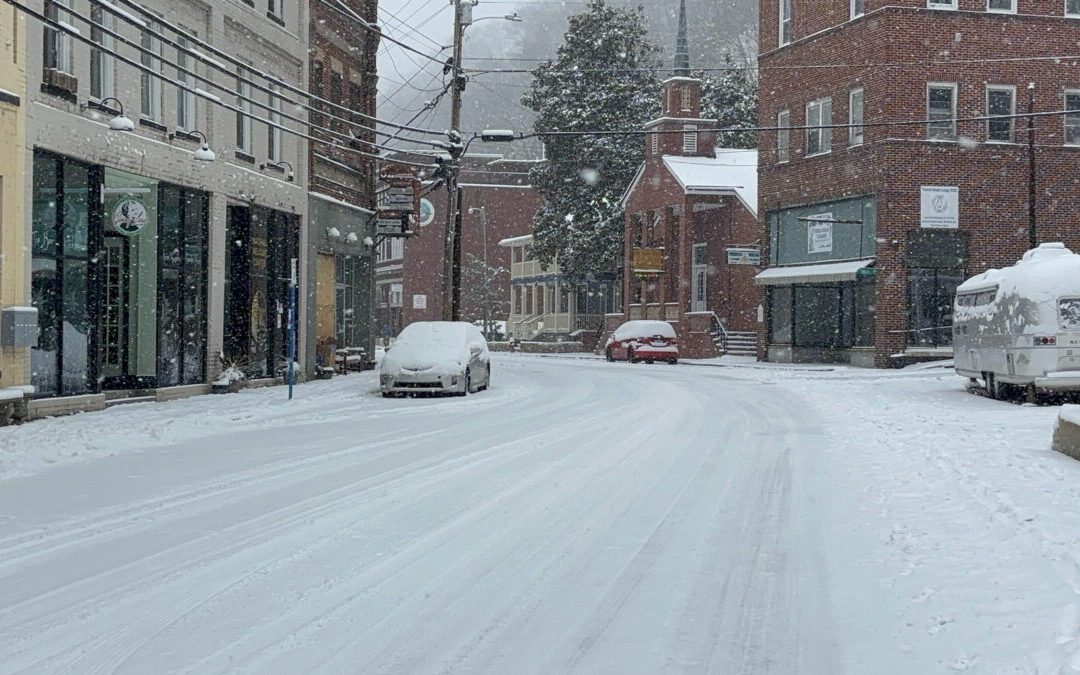
North Carolina will experience a deep shot of Arctic air this weekend, bringing frigid temperatures, gusty winds, and pockets of snow across the...
What a bomb cyclone is—and why North Carolina keeps seeing extreme weather
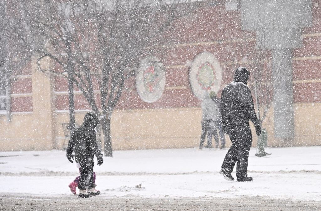
Back-to-back winter storms are testing North Carolina’s power grid. Across North Carolina, the signs of another winter storm were hard to miss: snow...
A ‘bomb cyclone’ could drop snow on North Carolina this weekend
These storms can produce heavy snow, strong winds, and coastal flooding, making them a major winter weather threat for areas along the Atlantic...
A ‘bomb cyclone’ could drop snow on North Carolina this weekend
These storms can produce heavy snow, strong winds, and coastal flooding, making them a major winter weather threat for areas along the Atlantic...
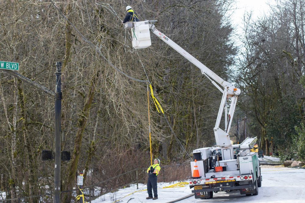
Everything you never learned about NC’s power grid—and how clean energy fits in
What keeps the lights on during winter storms has less to do with forecast, and more to do with how the state’s grid is designed. When Winter Storm...