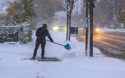
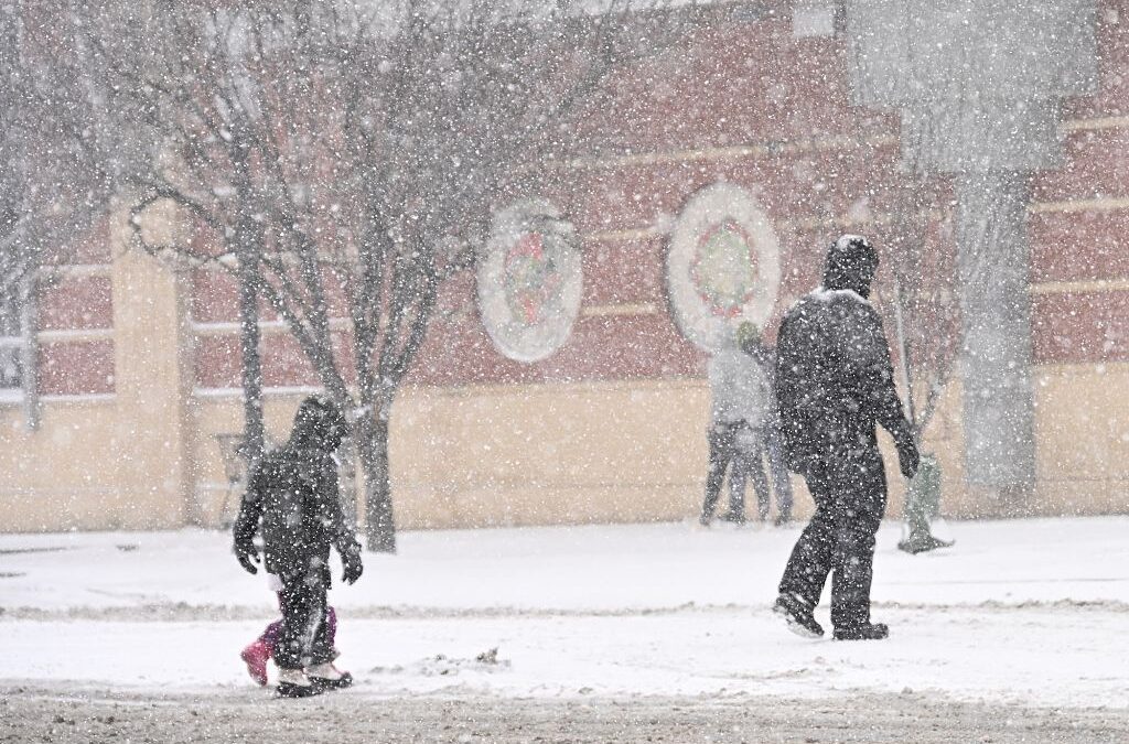
Downtown Marshall's south side of town is pictured here during the snowstorm Jan. 31. A new blast of Arctic air is expected to bring cold temperatures and snow to North Carolina this weekend (Feb. 6-8). (USA Today via Reuters)
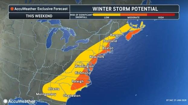
North Carolina will experience a deep shot of Arctic air this weekend, bringing frigid temperatures, gusty winds, and pockets of snow across the state.
North Carolina will experience a deep shot of Arctic air this weekend, bringing frigid temperatures, gusty winds, and pockets of snow across the state.
High pressure building from the north will lock in cold conditions from Friday night through Sunday, Feb. 6-8, making it feel much colder than the thermometer shows. Travelers and residents should prepare for dangerously cold wind chills, especially in exposed areas.
“A pair of frontal systems will bring periods of light to locally moderate snow for the Great Lakes today and into Friday,” the Weather Prediction Center wrote. “An arctic blast will bring frigid temperatures back to the Northeast and Mid-Atlantic by this weekend with snow showers and possibly snow squalls.”
Will North Carolina get more snow or ice? What to expect by region
As Arctic air settles over the state this weekend, North Carolina will see a mix of gusty winds, bitter cold, and isolated snow or ice, though impacts will vary by region.
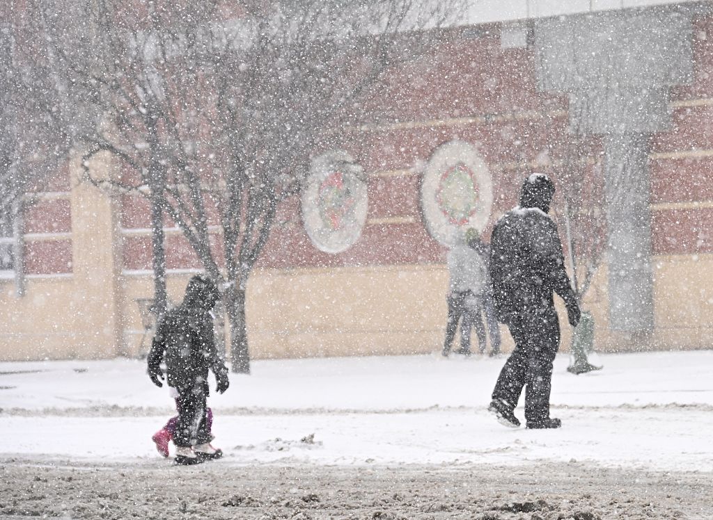
CHARLOTTE, USA – JANUARY 31: Snow covers Charlotte during winter storm Gianna, as bomb cyclone brings heavy snow in Charlotte NC, United States on January 31, 2026 (Photo by Peter Zay/Anadolu via Getty Images)
Western North Carolina: Snow showers and strong winds in the mountains
Snow showers are expected to develop along the Tennessee border Friday afternoon and evening, though accumulation totals are not certain.
Strong northwest winds will continue Saturday morning, particularly in the mountains and foothills. Gusts could reach 35–45 mph, making travel on exposed roads or mountain passes treacherous. Despite clear skies during the day, the combination of wind and low temperatures will make it feel much colder than actual readings.
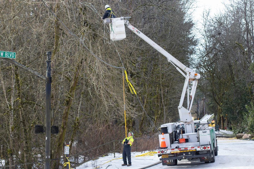
“Snow showers are expected to develop along the TN border Friday afternoon and evening behind a cold front, which could result in some travel impacts Friday night,” the National Weather Service in Greenville said. “Very gusty winds are expected to develop across the high elevations of the NC mountains late Friday night and Saturday morning, which could result in scattered power outages.”
Central North Carolina: Arctic chill and brisk winds
Across the Piedmont and Triangle region, temperatures will remain 10–20 degrees below normal this weekend. Highs are expected in the 30s, with lows dipping into the teens to low 20s Saturday night. Strong northwest winds behind Friday’s cold front will make the air feel even colder. Residents should be prepared for hazardous wind chills and plan accordingly for outdoor activities.
“It only takes a very light amount of ice to create hazardous travel – with bridges and overpasses the most hazardous as they will freeze first,” wrote the National Weather Service in Raleigh.
Eastern North Carolina: Cold, windy and possible black ice
Eastern North Carolina will see Arctic air advected in from the north, keeping highs in the mid-30s and lows in the 20s. Gusty northwest winds along the coast could reach 40–50 mph, producing wind chills well below freezing. While widespread snow is not expected, any lingering patches of ice from earlier this week could refreeze overnight, creating dangerous driving conditions.
Marine interests should note that gale-force winds and rough seas are likely from Friday night into Saturday night, with moderate to heavy freezing spray possible along the coast and Chesapeake Bay. Mariners should exercise extreme caution and monitor forecasts closely.
Reporting by Brandi D. Addison, USA TODAY NETWORK / Asheville Citizen Times
USA TODAY Network via Reuters Connect
Author

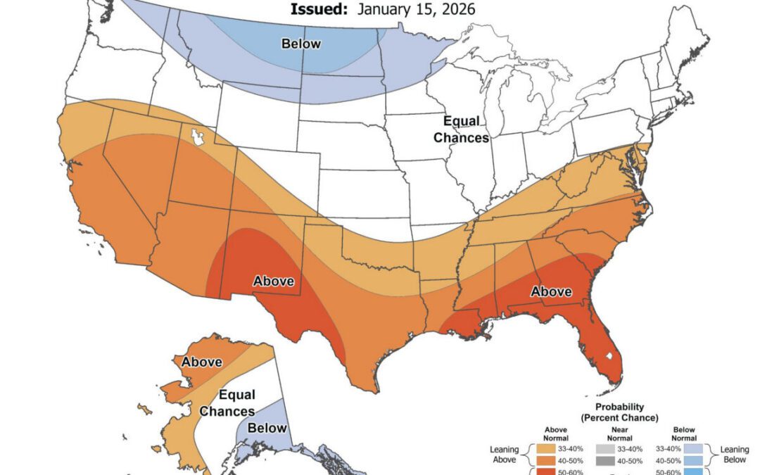
Will it be a warm spring in NC? See NOAA 2026 long-range forecast
Just over a month before the official start of spring, here's what weather forecasters are predicting for NC. As we head into February, the National...
What a bomb cyclone is—and why North Carolina keeps seeing extreme weather
Back-to-back winter storms are testing North Carolina’s power grid. Across North Carolina, the signs of another winter storm were hard to miss: snow...
A ‘bomb cyclone’ could drop snow on North Carolina this weekend
These storms can produce heavy snow, strong winds, and coastal flooding, making them a major winter weather threat for areas along the Atlantic...
A ‘bomb cyclone’ could drop snow on North Carolina this weekend
These storms can produce heavy snow, strong winds, and coastal flooding, making them a major winter weather threat for areas along the Atlantic...
Everything you never learned about NC’s power grid—and how clean energy fits in
What keeps the lights on during winter storms has less to do with forecast, and more to do with how the state’s grid is designed. When Winter Storm...